YMCA subdivision
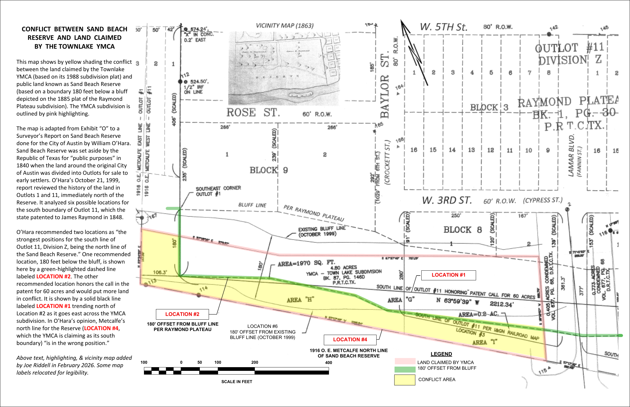
The 4.80-acre parcel boundary from the 1988 subdivision plat is outlined in pink.
Read the map
The conflict map compares the YMCA's 1988 subdivision boundary with survey locations analyzed by surveyor William O'Hara in 1999. The yellow area is the land Joe Riddell identifies as both claimed by the YMCA and part of Sand Beach Reserve.
The 4.80-acre parcel boundary from the 1988 subdivision plat is outlined in pink.
Yellow marks land that Riddell's map places inside both the YMCA claim and the Reserve.
The green dashed line is O'Hara's Location #2, measured from the bluff shown on the 1885 plat.
How the yellow area was measured
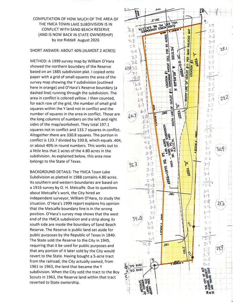
Riddell analysis Joe Riddell's August 2026 worksheet copies O'Hara's 1999 survey map onto a grid of small squares and counts them. Of 330.8 squares over the subdivision, 133.7 fall in the conflict area — about 40%, or a little under 2 of the 4.80 acres.
It is a manual, map-based estimate, not a boundary survey.
Open the full computation (PDF) ↗What the lines mean
The 1848 patent for Outlot 11 called for its south boundary to lie 60 yards—180 feet—below the bluff. Location #2 applies that distance to the bluff shown on the 1885 Raymond Plateau plat.
O'Hara's other recommended line honors the patent's call for 60 acres. It moves north as it crosses the YMCA parcel and would produce a larger overlap.
Metcalfe's 1916 line is the boundary used for the YMCA's south claim. O'Hara concluded it was in the wrong position.
Why the line matters
“The Grant hereby made to the City of Austin is made for public purposes and in the event of sale by the City of Austin, of the property herein granted, all parts thereof so sold shall revert to the State.”1945 State grant
The railroad sold a five-acre tract west of Lamar to Austin in 1961. Austin sold it to the Boy Scouts in 1963, and the Boy Scouts sold it to the YMCA in 1967.
Riddell's contention: Reserve land was included in the 1963 conveyance and that portion reverted to Texas at the moment of sale, so it could not pass into later private ownership.
1961 deed1963 resolution1963 deed1967 deed
The 1963 deed establishes the City's conveyance. The boundary placement and legal consequence are the analysis at issue. This site attributes that contention rather than presenting it as an adjudicated fact.
Read the survey record
O'Hara's report and map are online.
The archive includes O'Hara's 1999 surveyor's report, Exhibit O (O'Hara's boundary map), and the principal patents, plats, grant, and deeds needed to evaluate the west-of-Lamar boundary argument.
Open the O'Hara report →
Open Exhibit O →
Start with the 1848 patent →